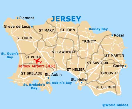
Jersey Airport (JER)
Orientation and Maps
(Jersey, Channel Islands)
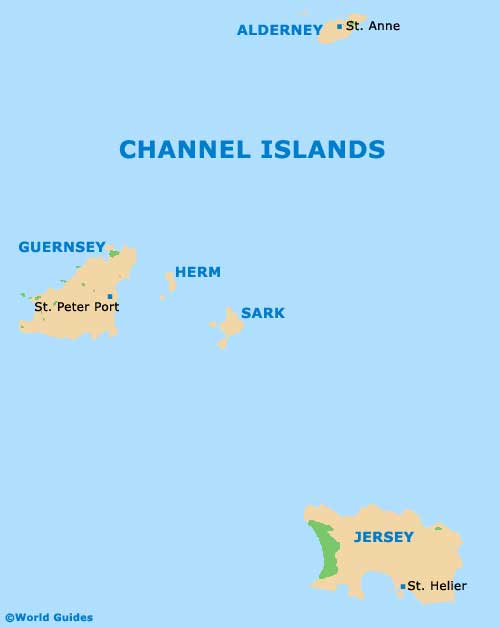
A popular holiday destination, the island of Jersey lies off the shore of Normandy in France. Jersey is located to the south of nearby Guernsey and south-west of Plymouth, England. One of the famous Channel Islands, Jersey covers around 118 square kilometres / 46 square miles and stands in the English Channel.
Sited within the parish of St. Peter, Jersey Airport (JER) can be found on the west central area of the island. St. Peter is one of Jersey's 12 different parishes and actually features two separate shorelines, with St. Aubin's Bay on its southeastern side and St. Ouen's Bay to the west.
Jersey Airport (JER) Maps: Important City Districts
The 12 individual parishes on the island of Jersey all have areas bordering the sea. Each parish is sub-divided into smaller regions known as 'vingtaines' and are laid out as follows:
- Grouville (south-east, previously known as St. Martin de Grouville)
- St. Brelade (south-west)
- St. Clement (south-east)
- St. Helier (south)
- St. John (north)
- St. Lawrence (south central)
- St. Martin (north-east, previously known as St. Martin le Vieux)
- St. Mary (north-west central)
- St. Ouen (north-west)
- St. Peter (west)
- St. Saviour (south-east)
- Trinity (north-east central)
Channel Islands Map
Jersey Map
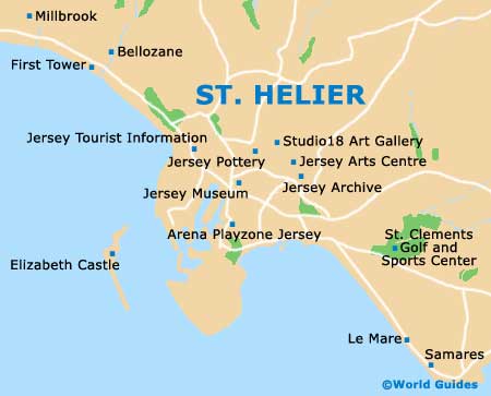
St. Hellier Map